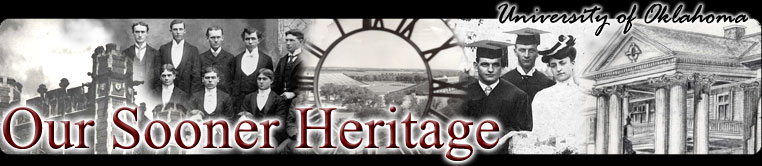
This excerpt from the 1925 Sanborn Fire Insurance Company map shows OUs Core Campus. It is the last map to show the drive that came off Asp Street and looped behind the administration building and connected to Elm Street on the west. This drive was a feature of Vernon Parringtons plan for the campus and it was along this drive that many of President Boyds trees flourished. We have only one photograph of this area and it may be seen in the Evans Hall frame to the right.
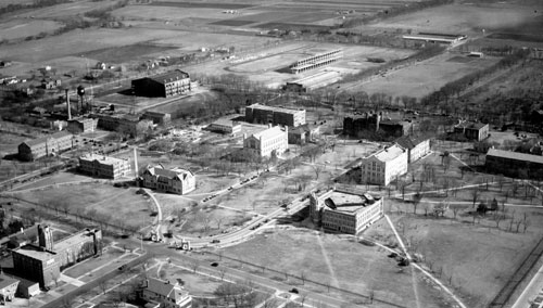
A 1927 aerial photograph looking southeasterly shows more clearly the rows of trees that ran parallel to OUs walks, roads and outer perimeters. Bizzell Library had not been constructed yet when this photograph was taken. A small segment of the drive behind Evans Hall may be seen between Evans and Buchanan Halls.
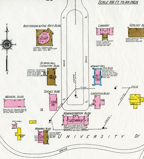
In 1930, just five years after the Sanborn map was published, construction of the Bizzell Memorial Library (right center), Hester-Robertson resident halls (extreme right center) and Hygeia Hall or the infirmary (right center), had eliminated the drive behind Evans Hall. This aerial photo shows how the universitys tree planting followed the walkways and roads in a linear pattern as opposed to being clustered. Some low shrubs may be seen along the arches to the north of the old library (Jacobson Hall) and Holmberg Hall.